


Rupac: Lima’s “City of Fire”
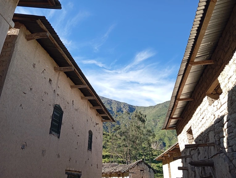
Empty streets, padlocked doors, shuttered windows in an abandoned village – a ghost town, wrapped in mist carried by the wind from the mountains. What happened? Where did the people go? There are no answers. Only desolation and silence, broken now and then by the song of birds and the sound of my traveller’s footsteps, my explorer’s steps.
I walk and observe: two-storey adobe houses with their wooden doors and windows, unpaved streets claimed by vegetation, and the abandoned temple —no prayers, no miracles, no devotees, no sinners. Then I hear other footsteps. I stop. Someone is approaching in San Salvador de Pampas, the spectral community spread across a mountain slope.
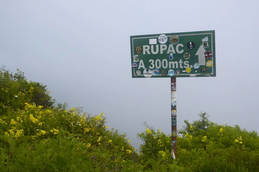
I see him. He sees me. We introduce ourselves. He is a muleteer, patiently guiding his hardy little donkey. I am an outsider, searching for the path that leads to the archaeological site and the cloud blanket of Rupac, the “City of Fire”. That is my destination. That is why I set off for the district of Atavillos Bajo in the province of Huaral, known as the “Capital of Agriculture” and the “Larder of Lima”.
A footpath beginning in Pampas (3,078 m a.s.l.) climbs up to what some grandly —and mistakenly— call the “Machu Picchu of Lima”. Don’t believe them. It’s an unnecessary comparison. Rupac is different. Rupac has its own charm. You’ll be disappointed if you come expecting a copy or replica of the marvellous Inca citadel.
Your experience will be completely different if you arrive with an open mind and a willingness to enjoy the peculiarities of the journey. After all, where else will you find a ghost town where there’s no fear and no wandering souls? Here, what will unsettle you is the desire to know: what happened, and where did the people go? … Do you want to know now, or would you rather hear it from a guide or a muleteer?
On the Road to Huaral and Rupac
To reveal or to keep the reason for the abandonment… that is the dilemma. And while I decide, let me explain that the first step to reach Rupac is to travel from Lima to Huaral. The distance between the two cities is 80 km, and the journey along the Panamericana Norte takes about 2 hours. Every day, buses and shared taxis run this route, with fares ranging from 10 to 30 soles.
Huaral, in the Lima Provinces region, is a deeply agricultural valley, with seedless oranges and mandarins among its main products. In recent years it has also earned a reputation as a gastronomic destination. Its signature dish is chancho al palo (wood-roasted pork), but in its countryside restaurants you’ll also find other local delights such as duck ceviche, duck in chilli sauce, and crispy fried guinea pig (chicharrón de cuy).
Apologies for straying down the path of flavours and tempting your appetite. Let’s get back to the route. Buses depart from Terminal Acho (Jirón Cajamarca 501, Rímac) and Estación Previ (Avenida Alfredo Mendiola 4120, Los Olivos). Near these stops you’ll also find cars and vans heading to the first stage of your journey to the “City of Fire”.
Once in Huaral, take a shared taxi towards La Florida (where you’ll need to pay 10 soles to access the archaeological site) and Pampas (81 km from Huaral). These vehicles leave from near the Pinasco petrol station and the terminal of the Zeta Bus company. The best option is to set off at dawn. For safety, arrange with the driver to pick you up. (Travel time: around 2 h 30 min. Cost: 25–30 soles).
Another option is to book the services of a travel agency. Full-day tours from Lima to Rupac usually run on Saturdays and Sundays, or during long weekends. From December to May, visits are more frequent as the cloud blanket covering the mountains is denser, especially at sunrise and in the late afternoons. Many travellers choose to camp overnight to enjoy this spectacular sight.
High-Altitude Hike
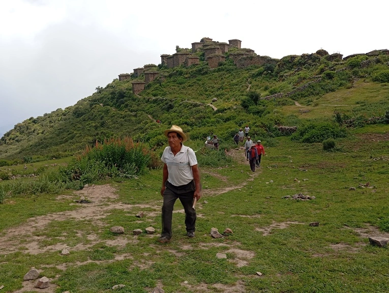
If I wanted to spark your curiosity, I could tell you that the muleteer and his little donkey weren’t real, but wandering souls condemned to roam forever. In their restless wanderings, they’d trick unsuspecting villagers and lead them down paths of doom. Terrified, the people of Pampas supposedly abandoned their homes and sought refuge in La Florida, where no spirits would dare bother them.
The migration —which took place in 1952— is the only truth behind the myth and legend I just invented. Everything else is pure fiction. The villagers didn’t leave out of fear —shall I tell you why or keep it to myself?— and the muleteer and his donkey are very much real; so real that both accompanied me on the 7.8 km climb up to Rupac (3500 m a.s.l.), though of course the donkey had it easy. After all, a true trekker carries their own backpack.
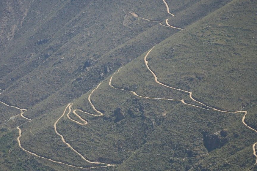
Enough with inventing myths and legends. It’s time to walk. Upwards, always upwards, along a path that winds its way up the mountain and dares to flirt with the void. Every step is a challenge. Your legs stiffen, your heart races. You tire, you persist, and you regain your spirit as the landscape unfolds: the mountains stretching to the horizon and the ghost town fading in the distance.
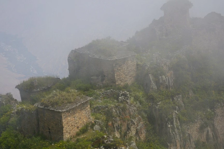
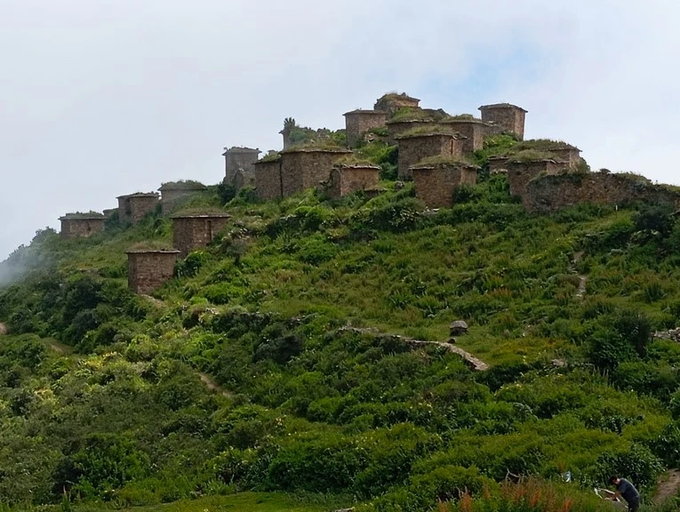
The mist grows ever thicker. Damp air seeps through the gaps in my clothing. “At dawn you can’t see a thing because of the cloud blanket,” the muleteer explains. I listen without stopping. I can’t stop. It’s been two hours since I left Pampas, and my destination shouldn’t be too far now. Yes, I’m close, I tell myself, as I catch sight of stone structures emerging through the haze.
I quicken my pace. Excitement builds. I’m eager to uncover “the architectural jewel of the Atavillos kingdom (1100–1400 AD)… (which) lies within a great surrounding wall. Inside, there are 51 different chambers, 25 of which remain intact,” as described in the Inventory of Tourist Resources by the Ministry of Foreign Trade and Tourism (Mincetur).
At Last in the “City of Fire”
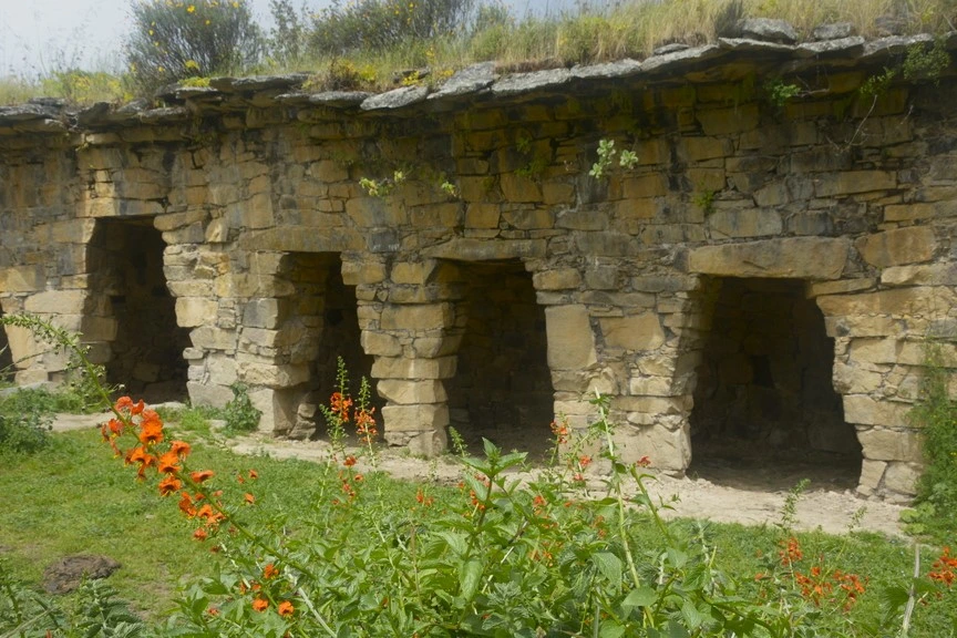
Patience. False alarm. This isn’t the “City of Fire” yet, but Marca Kullpi, a cluster of stone structures that precede my final destination. They too were built by the Atavillos. Coming originally from the Altiplano, the men and women of this pre-Hispanic people settled in the highlands of Huaral during the Wari–Tiwanaku predominance. After the fall of that empire, several kingdoms emerged, which were later absorbed into the Inca realm.
Time to press on. The last stretch towards Rupac reveals its kullpis (dwellings) made of adobe and finely carved stone, rising up to 10 metres high with as many as three levels; its chullpas (funerary towers), storehouses, chimneys, ventilation ducts and protective walls. Several researchers suggest this archaeological site once served a military role, thanks to its strategic location.
When I finally arrive, the fatigue disappears as I lose myself among the stone walls. Visiting this place was a brilliant idea – proof that a site doesn’t need to be Machu Picchu to be spectacular. Suddenly, a group of local villagers appear, busy tidying up the area. I approach, we greet each other, strike up a conversation. Their generosity shines through as they kindly share their lunch with me.
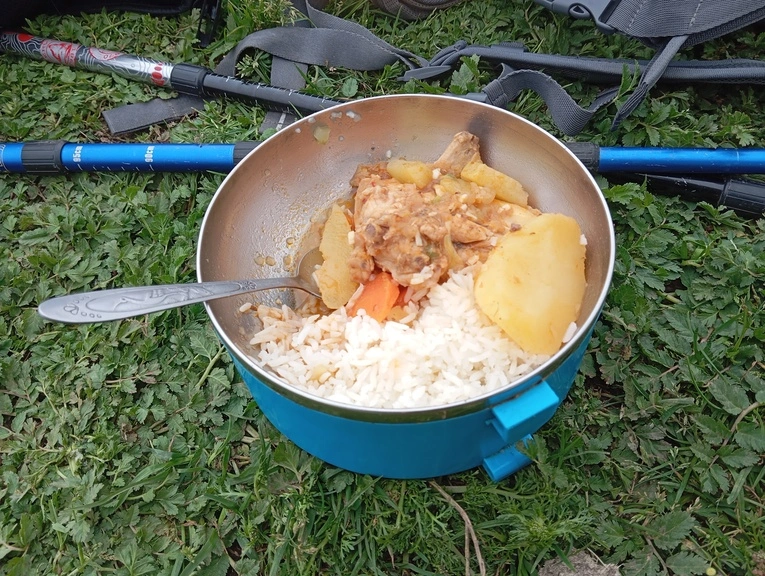
A good meal. A good chat. Together we began the journey back to the village their parents and grandparents once abandoned in search of a warmer and more fertile land. They didn’t go very far. Many settled in La Florida, which, as they say, “is just down there”. Many return to Pampas every 6th of August to honour their patron saint, San Salvador. On that day, the padlocks come off the doors and prayers once again echo inside the church.
The dilemma is over. Now you know why Pampas is a ghost town. I saved it for the end so that you would join me on this pilgrimage through the Huaral mountains. But one mystery remains. I’ve written that Rupac is the “City of Fire”, but you don’t yet know the reason. Here’s a clue: when you’re at the archaeological site, try to stay until sunset. The horizon will give you the answer.
September 30, 2025